How A/B guidance lines work
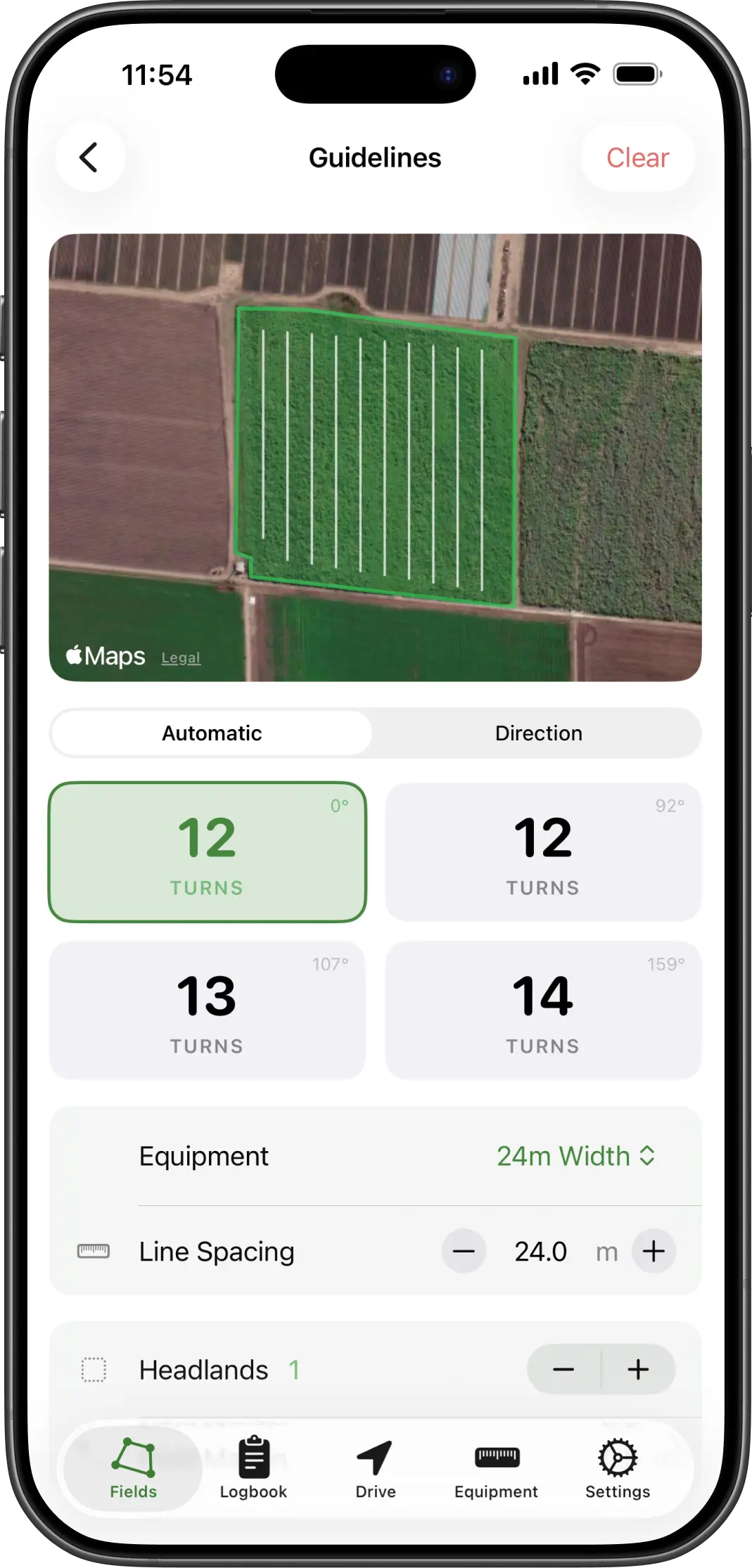
An A/B line is the simplest idea in precision agriculture and the one that does most of the work. You mark two points, A and B. The system draws a straight line through them, then repeats that line across the whole field at the width of your implement. Instead of judging the next pass off tyre marks, a spray line or the colour of the crop, you steer to a line that is exactly where it should be.
Why the implement width matters more than the GPS
The spacing between guidance lines is your working width, so that number is doing more for your result than the receiver is. Enter 24 metres for a 24.5 metre boom and you have designed in half a metre of overlap on every pass for the life of that setting, about two per cent of everything you apply, forever. Enter 25 and you have designed in a skip.
Measure the implement rather than trusting the brochure figure, especially on a boom that has been repaired, a spreader whose pattern depends on the product, or anything with worn discs. Then keep a saved profile per implement so you are not retyping it, and so the number that produced last season’s coverage maps is still the number in use.
The overlap cost calculator puts a figure on this. Most operators are surprised how quickly a consistent half metre adds up across a season.
Offset: where the implement actually runs
The GPS receiver, the phone in its cradle, is in the cab. The implement may not be directly behind it. An offset mower, a side-mounted spray boom or a trailing implement that runs to one side all put the worked ground somewhere other than where the phone is.
Setting a lateral offset tells the app how far left or right of the machine the implement centre sits. AgriPilot then guides on the implement centre rather than the phone: the cross-track figure, the pass the app thinks you are on, and the coverage it paints all shift by that amount. Without it, a system can be perfectly on the line and still leave a strip.
Setting your first line
1. Set your implement width first
Enter the working width of the implement you are pulling, and its offset if it does not run directly behind the machine. Every guidance line after this is spaced by that number, so an approximate width gives you approximate passes.
2. Drive to where your first pass starts
The A/B line is usually set along the longest straight edge of the field, or along a fence or headland you want the passes to run parallel to.
3. Drop point A
Tap A at the start of the pass. Nothing visible happens yet. The app now has one end of the line and is waiting for the other.
4. Drive the pass and drop point B
Drive to the far end of the pass and tap B. The app draws the line between the two points and fills the rest of the field with parallel lines spaced to your implement width.
5. Steer to the line
An on-screen indicator shows how far you are off the nearest pass and which way to correct. As you move into the next pass the guidance switches to it automatically.
If the field has a saved boundary, AgriPilot can work out a guideline direction for you from the shape of the boundary and your implement width, which saves driving the first pass just to define it.
Reading the cross-track number
Cross-track error is the perpendicular distance from the implement centre to the nearest guidance line, with an arrow or chevrons showing which way to steer to close it. It is the one number to watch while driving, and it has a useful property: it tells you which way to correct from your own point of view, whichever direction you are driving the pass. Turning at the headland and coming back does not invert the instruction.
Do not chase it to zero. On a phone receiver the position itself moves around by a metre or two, so a driver who corrects for every small reading ends up weaving, and a weaving pass costs more in overlap than a steady one that sits consistently half a metre off. Hold a steady line and let the small numbers wander.
What this does not do
A phone-based A/B line is visual guidance. It shows the driver where to steer; it does not steer the tractor, and it does not connect to the machine. Accuracy is that of the phone’s own GNSS receiver, typically three to five metres in an open field, rather than the two or three centimetres an RTK system gives.
For a wide boom, a spreader or a mower that is the difference between an overlap you can see and one you cannot, and it is worth having. For controlled traffic, for row crops you will return to with a different implement, or for anything where passes must repeat across seasons, it is not enough, and the honest answer is hardware. The comparison page sets out what each option costs and what it actually delivers.
Ready to try it
Put a line down your next paddock
AgriPilot sets A/B guidance from two taps and spaces the passes to the implement width you saved, with the cross-track figure on screen while you drive. There is a 7-day free trial.